Weeks 7/8/9:
Over the next three weeks your job is to gather information to answer your big questions, create a digital output to show your learning and plan a 'so what'.
1) as a group source information to answer your big questions (you are NOT allowed to google or go on Youtube on your devices)
2) Use an A3 storyboard planner to show how you are going to create your digital output (Keynote, Pages or Clips)
3) Create your digital output
4) Decide who and how you are going to share your learning, what is your 'so what'?
Research Groups:
The Pollution Quintuplets:
J.E.L: Josh, Ethan and Lochie
D.E.L: Declan, Elijah, Leo
H and J: Harris and Jacob
Double A's: Aiden and Abel
The Mount Hunters:
Golden Girls:
The Rivers: Gemma, Chloe, William
Volcanic Group: Lucas, Zavier and Olive
J.E.L: Josh, Ethan and Lochie
D.E.L: Declan, Elijah, Leo
H and J: Harris and Jacob
Double A's: Aiden and Abel
The Mount Hunters:
Golden Girls:
The Rivers: Gemma, Chloe, William
Volcanic Group: Lucas, Zavier and Olive
Groups:
|
Group of Plenty:
|
The B.O.P Kids:
|
Toi Moana:
|
Topography:
Read the information below on topography and complete the following tasks:
1) in your literacy book write a definition of topography in your own words
2) collect another blank map of the Bay of Plenty and glue this under your definition
3) have a go and using different shades of green and blue to show the contours of the land and harbour in the Bay of Plenty - don't forget the make a key to show what each colour means
Earth Science for Kids - Topography
What is topography?
Topography describes the physical features of an area of land. These features typically include natural formations such as mountains, rivers, lakes, and valleys. Manmade features such as roads, dams, and cities may also be included. Topography often records the various elevations of an area using a topographical map.
Topographical Features
Topography studies the elevation and location of landforms.
Topographical Map
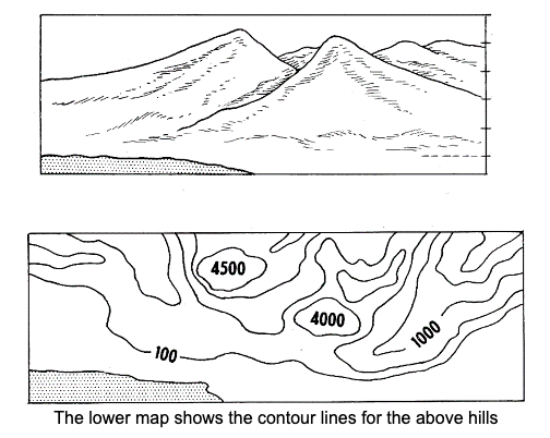
A topographical map is one that shows the physical features of the land. Besides just showing landforms such as mountains and rivers, the map also shows the elevation changes of the land. Elevation is shown using contour lines.
When a contour line is drawn on a map it represents a given elevation. Every point on the map touching the line should be the same elevation. On some maps, numbers on the lines will let you know what the elevation is for that line.
Contour lines next to each other will represent different elevations. The closer the contour lines are to each other, the steeper the slope of the land.
What is topography?
Topography describes the physical features of an area of land. These features typically include natural formations such as mountains, rivers, lakes, and valleys. Manmade features such as roads, dams, and cities may also be included. Topography often records the various elevations of an area using a topographical map.
Topographical Features
Topography studies the elevation and location of landforms.
- Landforms - Landforms studied in topography can include anything that physically impacts the area. Examples include mountains, hills, valleys, lakes, oceans, rivers, cities, dams, and roads.
- Elevation - The elevation, or height, of mountains and other objects is recorded as part of topography. It is usually recorded in reference to sea level (the surface of the ocean).
- Latitude - Latitude gives the north/south position of a location in reference from the equator. The equator is a horizontal line drawn around the middle of the Earth that is the same distance from the North Pole and the South Pole. The equator has a latitude of 0 degrees.
- Longitude - Longitude gives the east/west position of a location. Longitude is generally measured in degrees from the Prime Meridian.
Topographical Map
A topographical map is one that shows the physical features of the land. Besides just showing landforms such as mountains and rivers, the map also shows the elevation changes of the land. Elevation is shown using contour lines.
When a contour line is drawn on a map it represents a given elevation. Every point on the map touching the line should be the same elevation. On some maps, numbers on the lines will let you know what the elevation is for that line.
Contour lines next to each other will represent different elevations. The closer the contour lines are to each other, the steeper the slope of the land.
Ways Topography is Studied
There are a number of ways that information is gathered to make topographical maps. They can be divided into two primary methods: direct survey and indirect survey.
Direct survey - A direct survey is when a person on the ground uses surveying equipment, such as levels and clinometers, to directly measure the location and elevation of the land. You have probably seen a surveyor along the road sometime making measurements by looking through a leveling instrument sitting on a tall tripod.
Indirect survey - Remote areas may be mapped using indirect methods. These methods include satellite pictures, images taken from planes, radar, and sonar (underwater).
What is topography used for?
Topography has a number of uses including:
- Agriculture - Topography is often used in agriculture to determine how soil can be conserved and how water will flow over the land.
- Environment - Data from topography can help to conserve the environment. By understanding the contour of the land, scientists can determine how water and wind may cause erosion. They can help to establish conservation areas such as watersheds and wind blocks.
- Weather - The topography of the land can have an impact on weather patterns. Meteorologists use information on mountains, valleys, oceans, and lakes to help predict the weather.
- Military - Topography is also important to the military. Armies throughout history have used information on elevation, hills, water, and other landforms when planning their military strategy.
Our Wonderings and Discoveries:
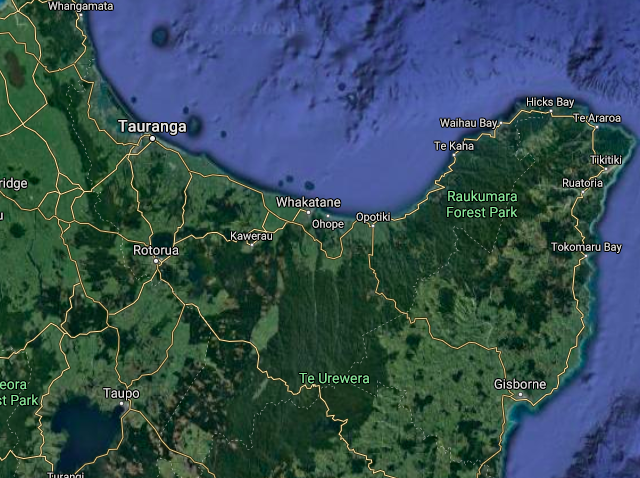
Bay of Plenty Places:
This week we are going to explore all of the different places that make the Bay of Plenty special:
- First you will need to look through the contents page of Bay of Plenty Places
- Choose three (3) of the places listed and read the articles on them
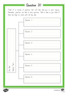
- Record any interesting facts on a tic, tac, toe note taking sheet and write down any wonderings or questions you now have on your Question It sheet
- Collect a blank map of The Bay of Plenty and label the main cities, rivers and lakes
- Add three (3) interesting facts about the three (3) places you read about to your map
Sea, Coast and Lowland:
- Read the text Sea, Coast and Lowland on Te Awa Encyclopedia and highlight the key words
- Record your key ideas in your 'tic, tac, toe' recording sheet
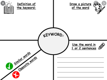
- Choose two words that you don't know the meaning of and complete a 'word work' chart for each
- Record any more questions you might have on your 'Question It' sheet
|
|
Ranges, Rivers and Forests:
- Read the text Ranges, Rivers and Forest on Te Awa Encyclopedia and highlight the key words.
- Once you have read all of the information you need to come up with some questions and wonderings that you have.
- Record these questions on your 'Question It! sheet'